How should a DIALux residential-road calculation model trees and parked vehicles?
Model tree canopies, parking strips and representative parked vehicles in a DIALux residential-road lighting calculation without confusing a clear-road result with the operating street.
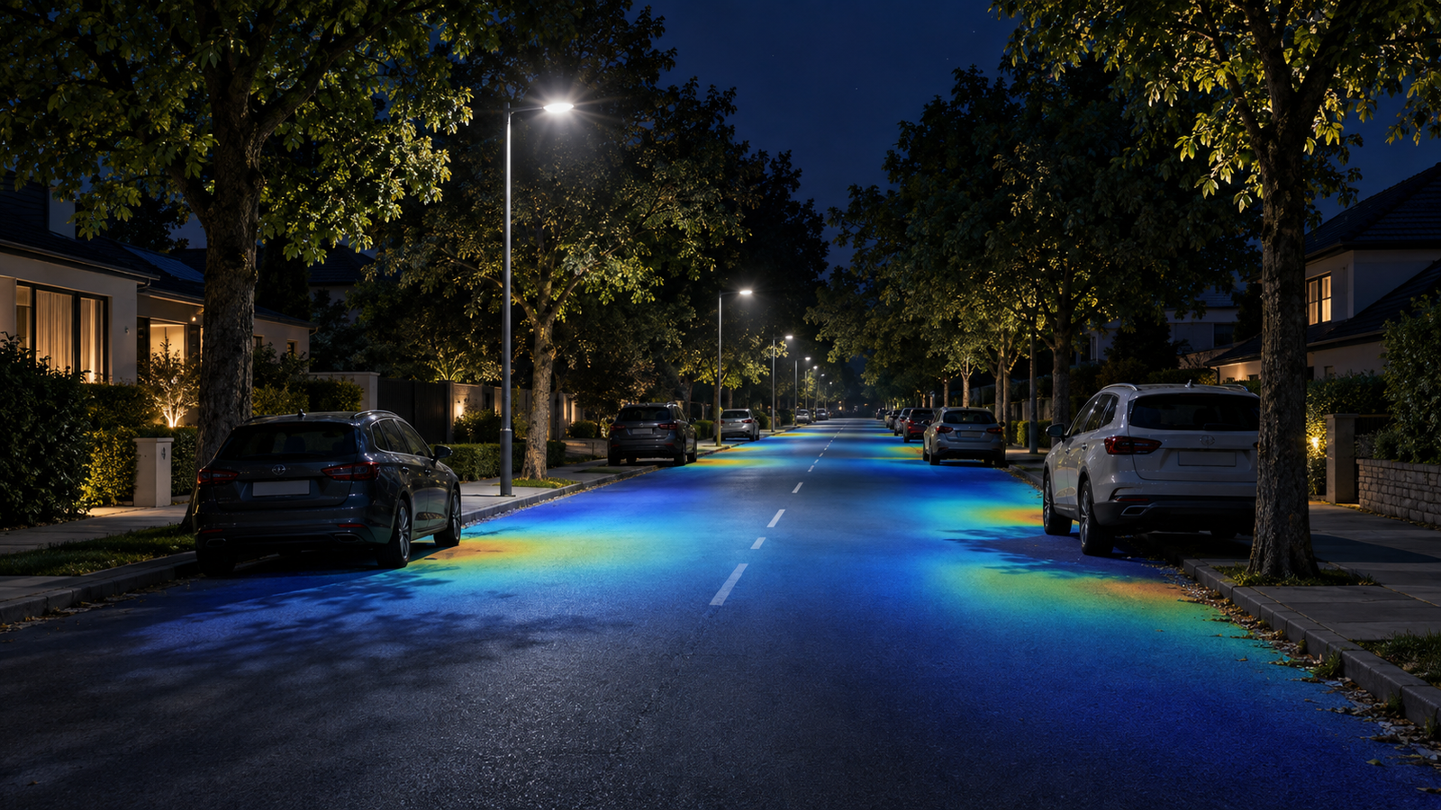
The short answer: calculate the road scheme, then test credible obstruction scenarios
A DIALux residential-road lighting calculation should begin with the correct street profile, lighting class, road surface, pole arrangement and verified luminaire photometry. Then test representative operating conditions for mature tree canopies and parked vehicles where they can block light, hide pedestrians or change the visible route. Keep the base photometry and evaluation criteria consistent so the scenario comparison reveals the obstruction rather than a changed calculation setup.
Do not fill the model with decorative objects and assume realism equals accuracy. Agree which trees, parking conditions, footpaths, crossings and driveways affect a real decision. The calculation can support design evaluation or submission, but the responsible client, consultant and relevant authority must confirm the applicable class, national requirements and acceptance method.
1. Build the complete street profile before adding obstructions
Start from a coordinated plan and cross-section showing carriageway width, lanes, sidewalks, cycle paths, parking strips, green verges, medians, driveways, junctions and property boundaries. Confirm pole coordinates, mounting heights, outreach, tilt, setbacks and any permitted relocation zone. Record the road-surface setting and the design stage of the geometry.
DIAL's current street-lighting guidance says DIALux evo can define single- or multi-lane roads together with sidewalks, cycle paths, parking and green strips, and automatically creates evaluation fields linked to the selected lighting class. Use those tools to represent the actual profile rather than accepting the default road scenario.
2. Treat tree geometry as an assumption that changes over time
Map the trees that will remain, their trunk positions, approximate canopy diameter and underside height, and their relationship to each luminaire. Distinguish mature retained trees from young planting. A sapling shown in a landscape plan may become a material obstruction later, while seasonal foliage can make one permanent canopy model too optimistic or too severe for the agreed assessment condition.
Use a simplified canopy only when its size, position and optical treatment are stated. Test a credible leaf-on condition where dense foliage can intercept light, and include a clearer condition only when the project needs that comparison. Do not claim that a visual tree object automatically participates in the calculation correctly; confirm the calculation method and, where necessary, use an outdoor-site model or documented obstruction geometry alongside the formal road-lighting result.
3. Model parked vehicles as scenarios, not permanent street construction
Parking bays or a parking strip belong in the street profile, but individual vehicles change. Select representative vehicle envelopes and occupancy conditions from the parking rules and observed or expected use. A normal evening condition might place vehicles in the most frequently occupied curbside section; a second scenario may test a taller vehicle near a pedestrian route or driveway when that changes visibility.
Record vehicle height, length, position and any exclusions. Avoid an empty-road calculation as the only evidence where curbside parking is expected, but also avoid packing every bay with identical tall vehicles if that condition is not credible. The useful question is whether a plausible vehicle arrangement creates local weak points that alter pole location, luminaire arrangement or pedestrian safeguards.
4. Keep formal road fields and pedestrian checks distinct
The selected road-lighting class determines the evaluation fields and metrics for the carriageway or other profile elements. Do not move or resize those fields merely to avoid a shadow. Review the applicable maintained values, uniformity and glare-related results using the correct observer, geometry and road-surface settings.
Trees and vehicles can also affect sidewalks, driveway mouths, crossings and the vertical visibility of pedestrians. Add clearly named calculation surfaces or points in an outdoor study where the project needs those checks, and state whether they are informative project criteria or formal standard fields. A compliant carriageway result should not be presented as proof that every adjacent pedestrian face or path is adequately visible.
5. Use the road module and outdoor model for different questions
DIALux evo's street-lighting workflow supports standards selection, custom street profiles, lighting classes, luminaire arrangements, optimisation and detailed documentation. Its outdoor workflow can construct a site from plans, position luminaires, add 3D objects, calculate selected areas or points and review isolines, value charts and false colours. These are complementary capabilities, not interchangeable proof.
Keep the formal road calculation as the traceable basis for the selected class. Use a coordinated outdoor model when tree shadows, vehicle screening, sidewalks or nearby properties require spatial checks that the simplified street profile does not explain. Align luminaire data, coordinates, maintenance assumptions and geometry between the two, and document any result that cannot be compared directly.
6. Diagnose a weak zone before changing the whole installation
When a canopy or vehicle creates a weak area, trace the cause and test focused responses: adjust pole spacing or setback, select a suitable optic, change mounting height or outreach, reposition a luminaire away from dense foliage, prune within an agreed maintenance plan, preserve a clear sight route, or add a separately controlled pedestrian-scale light where appropriate.
Recalculate the complete scheme after a material change. Improving one sidewalk point can worsen carriageway uniformity, increase glare or send more light toward bedroom windows. DIALux's current outdoor tools also support light-immission checks, but the project team must provide the applicable environmental zone, receptors, operating times and limits.
7. Issue a report that makes the scenarios reviewable
Identify the drawing revision, street profile, lighting class, road surface, pole geometry, luminaire and photometric files, maintenance basis, evaluation fields and calculation settings. For every obstruction scenario, show tree and vehicle geometry, active luminaires, named pedestrian checks and the controlling result locations using consistent scales where visual comparisons are made.
State limitations such as future canopy growth, pruning, seasonal foliage, uncertain parking occupancy, vehicle mix, installation tolerances and provisional landscape information. A DIALux residential-road calculation can support option selection, coordination or a submission package; it does not control parking, maintain vegetation, certify installed performance or grant authority approval.
Residential-road obstruction decision checklist
Before modelling, confirm: (1) the approved road and footpath geometry; (2) parking and green-strip layout; (3) retained and proposed tree positions with credible mature dimensions; (4) representative parking conditions; (5) exact luminaires, photometry and pole geometry; and (6) the applicable class, national rules, maintenance basis and sensitive receptors.
Before issue, verify: (1) formal road fields remain correctly defined; (2) pedestrian checks are named and not confused with standard fields; (3) tree and vehicle scenarios use comparable settings; (4) minima, uniformity, glare and shadow locations are reviewed; (5) any mitigation is coordinated with landscaping, parking and property constraints; and (6) assumptions and approval responsibility are explicit.
Authoritative references used for this guide
DIAL's official street-lighting documentation describes standards selection, configurable road profiles with sidewalks, cycle paths, parking and green strips, adjustable lighting classes, luminaire arrangements, optimisation, evaluation fields and structured result documentation. It also notes that national requirements should be checked because lighting-class requirements vary by country.
DIAL's official outdoor-lighting documentation covers plan-based construction, selected-area and point calculations, 3D objects, isolines, value charts, false colours, lighting scenes and light-immission quantities. The current DIALux FAQ lists EN 13201 and several CIE road-lighting references among supported standards. Use the licensed standard, applicable national adoption and project brief to establish criteria; this guide does not reproduce or replace them.
Frequently asked questions
Should every parked vehicle be included in a DIALux residential-road model?
No. Model a small set of representative occupancy and vehicle-height scenarios that can change a lighting decision. Record the assumptions, and keep the formal street profile separate from temporary vehicles.
Can a clear-road DIALux result prove the street will work beneath mature trees?
No. Mature canopies can intercept light and create local shadows on carriageways, sidewalks or driveways. Test a credible canopy condition and coordinate lighting, planting and maintenance decisions before relying on the layout.